Raster tiles – a quick overview
Raster tiles consist of pre-rendered images which are then stitched together on the client side, in a grid arrangement, to show a map at various zoom levels.
Map tiles are typically 256 × 256 pixels, or 512 × 512 for high-res (retina) tiles.
Key aspects of raster tiles
Here are three benefits of raster tiles, and some of their limitations.
Simple implementation
Raster maps simply show .png files on screen, which requires almost no processing power.
Since every modern mapping library across all front-end languages includes native support for raster maps, you can integrate high-quality visuals without the need for custom programming, complex debugging or heavy battery use.
Unmatched detail
Companies that provide raster tiles can incorporate intricate drawing effects and textures that would be intensive for a browser or mobile device to process in real-time.
Performance stability
Because the heavy lifting happens server-side, the client-side experience remains smooth and consistent across various hardware.
Limitations
Raster tiles are pre-rendered for a fixed set of zoom levels, with north at the top. End-users can pan and zoom the map, but the transitions between zoom levels aren’t smooth, and the map can’t be rotated or tilted.
The map’s appearance is fixed on the server, so it can’t be restyled client-side. Switching to a dark mode or changing the label language, for example, needs a separate set of tiles.
Since the tiles are just images, end-users can’t click on the roads, buildings and other features shown in the map. You can still add your own markers and pop-ups on top of it, though.

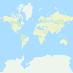
Lower zoom levels: towns, major roads and route networks across a wide area

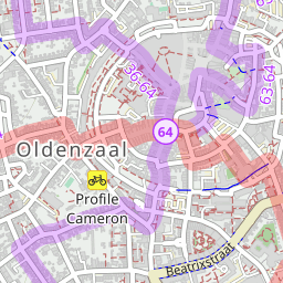
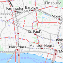
Higher zoom levels: individual streets, landmarks and finer detail
Are raster tiles the same as map tiles?
Strictly speaking, “map tiles” covers any map that’s split into a grid of tiles, so it includes both raster and vector tiles. In practice, though, “map tiles” usually means raster tiles, since they’ve been around for much longer.
We follow that convention on our site. Our Map Tiles API serves raster tiles, and our vector tiles are available through our Vector Sources API.
Downloading raster tiles
Some tile providers’ terms only allow tiles to be shown while the user is online. The tiles can’t be stored, so the map disappears as soon as the user loses their connection.
Other tile providers, including Thunderforest, allow tiles to be stored for offline use, in two ways.
Caching tiles that have already been viewed
Your app can keep the tiles that a user has already seen, and show them again later when the user is offline.
Bulk downloading
Your app can also download tiles that the user hasn’t seen yet, to prepare areas in advance for offline use. For example, a hiking app could download all the tiles along a planned route before the user sets off.
OpenStreetMap and raster tiles
The standard map on openstreetmap.org is itself made of raster tiles. They’re served by the OpenStreetMap Foundation’s own tile servers, which run largely on donated hardware and hosting, and are intended mainly for OpenStreetMap’s volunteer mappers.
“OpenStreetMap data is free for everyone to use. Our tile servers are not.”
So while you can use the OpenStreetMap tile servers for demos and other light use, they aren’t suitable for commercial projects. For those, you’ll usually need a commercial provider of map tiles. Alternatively, you can run your own tile server, although that’s a significant undertaking.
Raster vs vector – which is better?
Whether you use raster or vector tiles depends on your use case.
If you need smooth zooming, rotation and tilting, or want your customers to be able to click on features in the map, then vector tiles would be best.
If ease of implementation and consistent performance are your priorities, then raster tiles are an excellent choice.
Read our article about vector vs raster maps
Get started today
Test out your ideas with our free plan. Paid plans from $125 per month.