The story behind OpenCycleMap
By company founder Andy Allan
OpenCycleMap was the first map we developed, and launched in 2007.
I started working on it after spending a year working as a volunteer mapper for OpenStreetMap. I became interested in creating my own cartography, showing some of the bike parking and bike routes that we’d mapped.
Since then, OpenCycleMap has gone through hundreds of iterations, and remains extremely popular with our customers around the world.
Initial challenges – technical issues
When I first created OpenCycleMap the biggest challenge was around the cartography. Some of the things I wanted to do – such as the translucent cycle route highlights – weren’t possible. So we had to develop a workaround, creating multiple map images and layering them together.
Recent challenges – international differences and lots of data
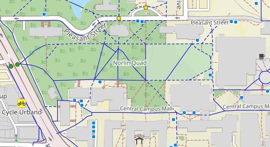
One of our next challenges was around the increasing amounts of data being added to OpenStreetMap. Whenever we show new categories of features on our maps, it encourages more OpenStreetMap volunteers to add those features to the OpenStreetMap database. However, these additional features means our maps can quickly become too crowded.
I’ve had to adjust the cartography several times to fit more details in, and rework the colour schemes to ensure the map is still legible in busy areas.
Another challenge is the international nature of the map, and the differences in cycling infrastructure in different countries.
There’s the concept of a “cycling node network”, which is popular in the Netherlands and Belgium. The junctions between cycling routes have numbered signposts, rather than the routes themselves.
In some countries being able to refill your water bottle is critical, in other countries ferries or chairlifts are parts of cycling routes. It’s a challenge to make OpenCycleMap the best cycling map in so many different situations.

Success – clear surface information
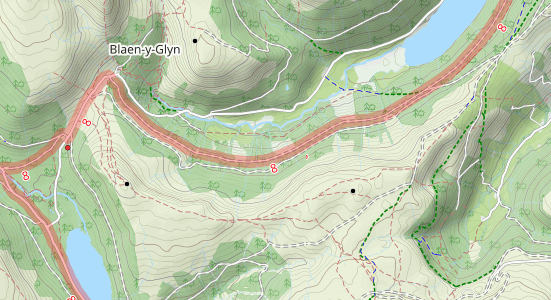
I’m particularly pleased with the surface information being shown in an intuitive manner, with solid lines for hard surfaces like concrete and ashpalt and short dashes for the soft surfaces like sand and earth.
I’m also pleased with a few ‘Easter Eggs’ that I have sneaked in over the years. I don’t want to spoil all the surprises, but let’s share one of them - if a pub has internet access it gets a different icon!

Updates – global coverage, hourly updates
There’s been lots of iterations to OpenCycleMap, not only in terms of cartography, but also in terms of the technology used to create it.
Originally it was only available for certain parts of the world, then more regions were slowly added, until it was available globally.
At that point it was only updated weekly, but nowadays it’s updated every few hours. It’s come a long way.
Get started with OpenCycleMap Preview OpenCycleMap
Free plan available - no credit card required