OpenCycleMap – A map for developers
Save hours of your time altering generic, bland maps to make them suitable for cyclists. We’ve already done the work.
OpenCycleMap is used by hundreds of companies and organisations worldwide. This map is updated every few hours.
Free plan available - no credit card required
A cycling map for web apps and mobile devices
Designed to be easy to read on any device, OpenCycleMap provides all the information cyclists need whether they are touring, racing or mountain biking.

Hand-curated Detail
Make it easy for your cycling customers to plan their routes
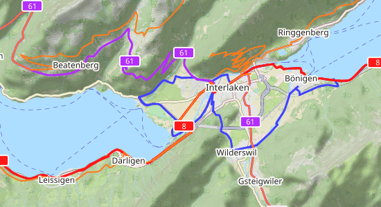
Wherever your customers are cycling, OpenCycleMap clearly shows signed and numbered cycling routes using the correct labelling for each country.
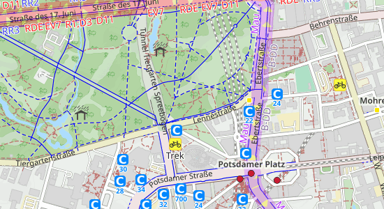
OpenCycleMap also surfaces points of interest for cyclists, including:
- Bike parking
- Bike shops
- Bike repair stands
- Cafes
- Drinking water refills
- Accomodation options (campsites, B&Bs, etc)

Thoughtful Design
Thoughtful design means your customers always know where they are and what they can expect
Cyclists need to know the state and elevation of roads and paths. It can mean the difference between a great ride and a disaster.
-
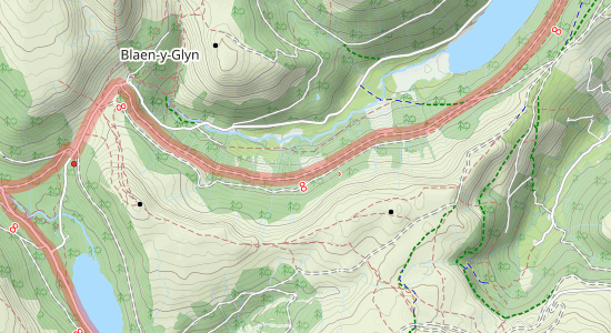
Surface types for paths are shown in an intuitive manner, with solid lines for hard surfaces like concrete and ashpalt and short dashes for the soft surfaces like sand and earth.
-
Contours and elevation shading are easy to read, meaning cyclists can quickly see whether they need to plan for hill climbing and fast descents.
Cartographer and company founder
Andy Allan
“One of the main challenges we faced is the international nature of the map, and the differences in cycling infrastructure in different countries.
There’s the concept of a “cycling node network”, which is popular in the Netherlands and Belgium. The junctions between cycling routes have numbered signposts, rather than the routes themselves.
In some countries being able to refill your water bottle is critical, in other countries ferries or chairlifts are parts of cycling routes. It’s a challenge to make OpenCycleMap the best cycling map in so many different situations.”

Regular Updates
Regular improvements mean your customers will always have the most recent information
We update OpenCycleMap every few hours, whether that means implementing changes from our source material (OpenStreetMap) or making our own changes to improve clarity.
We recently refined path grading, for example.
Available in our maps APIs:
Created in-house using our Vector Sources API:
Use Cases
OpenCycleMap is mainly used on apps and websites aimed at cyclists. However, it does have broader appeal.
- Cycling apps
- Activity and adventure apps
- Backcountry and geocaching apps